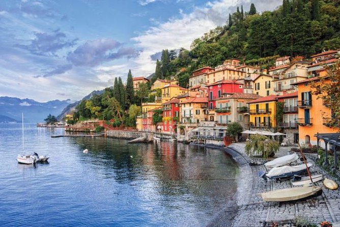
From Bellagio to Monte Nuvolone Bellagio
From the center of Bellagio, follow the coastal provincial road of the lake in the direction of Como for one kilometer to the town of Guggiate. From the square of the Church of Sant’Andrea, take the right and cross the whole hamlet, then cross the Perlo torrent with a bridge and take a narrow staircase that climbs to cross an asphalted road that ends near a farmhouse.
Continue on the path that climbs to the left and reaches a vast grassy terrace between a plant of conifers, on the right, and olive and fruit trees, on the left.
After passing the Cascina Cagnanica, go up among high ivy-covered walls, then, neglecting the detour to the right for the hamlet of Vergonese (Trail n ° 3), continue straight ahead to the town of Perlo (at 0.30 am). Going down a few meters from the paved road that connects Bellagio to Pian Rancio, you go to the stream at the Gole del Perlo where the water flows foaming between interesting potholes dug into erratic serpentine boulders, where an arched pedestrian bridge connects the two banks .
From Perlo, continue along the path indicated by the Trail n ° 4 and located on the left hydrographic bank: it rises with a flight of steps to the left of the last houses of the town, then passes a farmhouse and is immersed in a thick chestnut grove.
Where the valley narrows, the path reassembles its side with steep bends and long stretches of steps.
You reach a grassy plain, known as Bégola, with two discontinuously inhabited farmhouses.
Beyond a dovecote, the path of the path widens into a cart track, runs alongside a demolished farmhouse, overcomes the remains of ancient terraces, partially now ambushed, and climbs with a slight slope up to Brogno, a pleasant village at altitude indicated by the magnificent Villa Park Mariani.
In Brogno, leave the path to the right for Cascina Pelo on the right and instead of going down the road in the direction of Bellagio, turn right and go up the cart track towards a not very dense forest. At the first hairpin bend, you leave the cart track and continue on a sheep track indicated by Trail No. 4 which continues flat along the coast along the side of the valley, at the base of a limestone wall and up to the farmhouses in the Séller locality, at 736 m. where it is grafted onto an agricultural road between meadows and conifer spots.
After crossing the stream you come out into a clearing with an isolated chapel and with the background of Monte S. Primo. Now you climb over a ridge between clearings and terraced meadows and go to the underlying town of Rovenza anticipated by a fountain, at 724 m above sea level. Here you take the continuation of the carriage road which detaches from that for Pian Rancio and which continues with a natural background up to the Paùm pasture.
Following the cart track you buy altitude with two series of hairpin bends and upstream of the locality of Taiana, in correspondence with a beautiful boulder where there is the Trail sign with the number 11, take a cart track heading north to a new one construction. Now continue on the path that runs along the coast and crosses a dense scrub of larches, then passes between clearings and groves of birch, beech, hornbeam and chestnut trees.
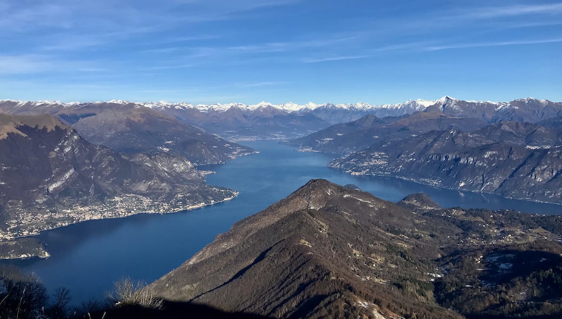
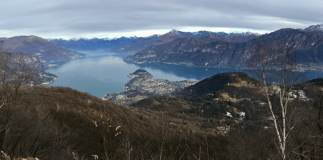
At this point you reach, with a slight climb, the ridge that branches off from the north ridge of Monte San Primo and in the locality of Ròccolo, at 973 m. you can admire a magnificent panorama of Lake Como, above Lezzeno: the Comacina Island with the Zoca de L’Oli and further south the entrance to the Valle d intelvi are right in front of us, on the opposite side of the lake.
From the neck of Roccolo, Mount Nuvolone appears to us as a summit with steep sides covered by dense vegetation, from which limestone white rocky walls emerge.
The path now runs on the eastern side of Nuvolone, halfway up the hill and avoids the rocks with a long tour that winds its way to the right.
At the height of a natural cave transformed into a chapel, you climb steeply between rocky outcrops beyond which, leaving the track that climbs steeply up to the summit on the left, you continue, first among the birches, then among the fir trees, up to the saddle that it lies between the summit and the summit in the north.
We are now at 1058 m. and here stands an old ruined hut, once used as a deposit for hay made from cutting high meadows.
From this hut continue to the right, making your way through young fir trees, until you succeed in a short time on the wooded summit of the north of Monte Nuvolone which dominates the Bellagio Peninsula with Punta Spartivento dividing the branches of Como and Lecco del Lario.
The Larian Pre-Alps that lock them in stand out magnificent in front of us. The climb to the real summit of Nuvolone is not of great interest as the dense vegetation precludes much of the panorama. Numerous and very suggestive are the Erratic Boulders, scattered almost everywhere.
(Lake Como system)
(source Comunità Montana Triangolo Lariano)